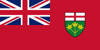
Flag of Ontario
- Provincial Capital » Toronto
- Also largest city in all of Canada
Facts
- Ontario is a province in Canada.
- Ontario is the most populated province in Canada.
- With a population of more than 13.5 million, Ontario is home to about 2 in 5 Canadians. More than 85% live in urban centres, largely in cities on the shores of the Great Lakes.
- Aboriginal peoples – First Nation, Métis and Inuit – make up about 2% of Ontario’s population and about one-fifth of all Aboriginal people in Canada. First Nations peoples in Ontario include Algonquian-speaking Cree, Oji-Cree, Algonquin, Ojibwa, Odawa, Potawatomi and Delaware, plus the Iroquoian-speaking Six Nations (Mohawk, Oneida, Onondaga, Cayuga, Seneca and Tuscarora).
- Ontario’s population growth has depended on immigration ever since the American Revolution sent Loyalists north to Canada. Today, 40 % of the approximately 250,000 people who immigrate to Canada each year choose to settle in Ontario.
- Toronto has been called the most multicultural city in the world, where more than 100 languages and dialects are spoken.
- Toronto is the capital of Ontario and the largest city in Canada.
- Ontario’s more than 250,000 lakes contain about one-fifth of the world’s fresh water.
- Cultures from around the world thrive and are celebrated in Ontario with festivals such as Caribbean Carnival, Oktoberfest and the Canadian Aboriginal Festival.
- English is Ontario’s official language.
- There are about 5 million households in Ontario and the life expectancy is about 79 years for men and 84 years for women.
Geography
- Total Area » 1,076,395 sq km (415,598 sq mi)
- Nunavut, Quebec, and the Northwest Territories (in that order) have more total area.
- If comparing only land area, British Columbia has more dry land than Ontario.
The varied landscape of Ontario includes the vast, rocky and mineral-rich Canadian Shield, which separates the fertile farmland in the south and the grassy lowlands of the north. Travellers can enjoy the many experiences, from a wilderness expedition in the north, to a “shop till you drop into your theatre seat” in Toronto, Canada’s largest city (also the 4th largest city in North America after Mexico City, New York and Los Angeles).
- Ontario is Canada’s second largest province (after Quebec, but also after the territories of Nunavut and Northwest Territories), covering more than 1 million square kilometres (415,000 square miles) – an area larger than France and Spain combined.
- Manitoulin Island in Georgian Bay is the world’s largest freshwater island, covering 2,766 square kilometres (1,068 square miles)
- Ontario is bounded by Quebec to the east, Manitoba to the west, Hudson Bay and James Bay to the north, the St. Lawrence River and the Great Lakes (Lake Superior, Lake Michigan, Lake Huron, Lake Erie and Lake Ontario) to the south along with the border with the U.S.A.
Maps
Maps » Provincial Parks
Weather
- Ontario Weather – Environment Canada
Road Trips
- The Long Sault Parkway goes over a group of eleven islands in the St. Lawrence River west of Cornwall, Ontario.
National Parks
- Bruce Peninsula National Park (Wikipedia / Twitter)
- This is the traditional home of the Saugeen Ojibway First Nations.
- This stunning national park is situated between Georgian Bay and Lake Huron, along Southern Ontario’s UNESCO Niagara Escarpment Biosphere Reserve (Wikipedia)
- The Bruce Trail
- Canada’s oldest footpath, the Bruce Trail connects you to the wonders of the Niagara Escarpment
- Georgian Bay Islands National Park
- Point Pelee National Park
- Pukaskwa National Park
- Rouge National Urban Park
- Thousand Islands National Park
National Conservation Areas
- Lake Superior National Marine Conservation Area is a National Marine Conservation Area (NMCA) on the north shore of Lake Superior in Ontario, and is a unit of the national park system. Established on September 1, 2015, it is the largest freshwater marine protected area in the world.
Provincial Parks
- Algonquin Provincial Park – Unfortunately, there is major development in an and around the park. One of the few parks in Canada where logging operations take place.
This page was updated September 27, 2023